Showing posts with label waterfall. Show all posts

Monday, September 28, 2009

Perdik Falls, Selangor

Its been slightly more than 2 weeks since my last post and I wish to apologise to my dear loyal readers (if any :-p) for making you guys wait anxiously.

Well, its been a roller coaster of a past few weeks for me. Sometimes I have the time to blog, but i just run out of things to say. Other times, when i feel like blogging, i either dont have the time or I just prefer to keep those thoughts to myself. After all, not everything I put up here makes nice reading for people.

OK, back to today's post. Perdik Falls. Where is this place? Its located around the mountainous region of Hulu Langat. its one of the lesser known falls and harder to locate. Even with the GPS co-ordinates which I found online, the navigation system repeatedly tried to lead me to use a different route, the Ampang route rather than the straight-forward, Hulu Langat way. Moredetails about the falls can be found in this website. Please do note that while I encourage people to visit the falls, please keep the environment clean. Do not leave your rubbish everywhere in the forest reserve. Meanwhile, enjoy some pictures we took on that trip.


Interested to go? Remember to keep the place clean!
Its about 30-40 mins trek with a slight uphill trek just before the waterfall. You can hear the sounds of the waterfall and river along the trail.
SOrry about the pictures as they are disorganised. They are in reverse chronological order, but i hope you wont mind :-p
As for the GPS co-ordinates, this is the 1 I have using my own GPS machine (Nokia E52)
PArking at the start of the trail : N 03.12.415; E101.50.072
The waterfall itself: N 03.12. 747; E 101.49.561
Boodyboy, out!!

Sunday, July 19, 2009

Lata Kijang, Negeri Sembilan

THis is my post about Lata Kijang, which i just visited recently. Lata means waterfall.w

This Lata Kijang was just something crazy I decided to do. THinking about it now, it was a pretty risky and dumb thing to do. Driving a Perodua Myvi deep into Banjaran Titiwangsa (Main Range) to find a waterfall. THe trail is so bad that I recommend you use a 4WD to get to this fall the next time.

Some parts of the road were tarred, some cement, but more than half the way, the roads are all broken and some just a trail of pebbles and rocks. I pity my poor Myvi whow as forced to go along this ride. Her suspension must have hurt.

The journey started from the old road to Hulu Langat in Batu 9, Cheras. At the cross junction that goes to Ampang (to the left); Batu 18 Hulu Langat, Tekala, Gabai and Batangsi Falls (Straight); and to Semenyih (right), we turned right. Then drive straight and you will pass a winding road up the hills. YOu will also pass by some Orang Asli settlements along the way. After about 20 minutes, you will reach a T junction. To the right will be Semenyih town or Kajang, and the left is to Kuala Klawang and Batu 18 Hulu Langat. Turn left here. You will see los of monkey by the road side here and you will definitely not miss the Semenyih Dam on your right.
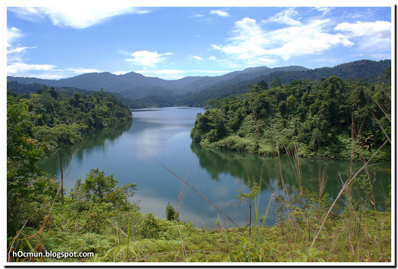
Semenyih Dam


After passing Semenyih dam, you will continue driving straight until you see a turning to the left, to Batu 18 Hulu Langat. Continue heading straight. More windign roads up and down the hill from here. I love driving these type of roads. Country road with little or no traffic.

Now all I need is an open top convertible (Peugeot 308 cabriolet, Audi TT insert your dream car here) and I'm set for the perfect weekend drive. Once you reach the top of the hill, theere will be a sign which serves as the border between Selangor and Negeri Sembilan.

ITs about 10-15 minutes drive from the border. And you will see a signboard saying Gunung Hantu Besar / Lata Kijang. Turn left and drive straight. once you drive past a river, get ready to turn left. From that turning, it is only about 20km to the waterfall.


But here is where the 4WD adventure begins, the road is in pretty bad condition. If you have any car that is pretty low or has skirting, avoid driving on ths trail. Or else you will cry. Just drive straight for about 30-45 minutes before you reach a FELCRA settlement, then continue straight. You will pass a few more settlements before reaching the waterfall. Just befre you reach the waterfall, you will pass by a camping site which is quite big. ANd the road jsut before the waterfall is in good condition. How does LAta Kijang look like? Here it is!! I've also put up a picture of it from ahelicopter point of view. Its right in the middle of nowhere.


ANy1 wants to visit this place and in need of a guide? Heheheh...


Boodyboy, out!!!

Monday, June 29, 2009

Chiling Falls

Hey People,

I just thought I'd share a bit on Chiling Falls. Seems like nobody's posting anything about actually going anywhere, so I guess this is a start; although I have not been there recently. This is from previous visits of mine to Chiling Falls. I have been there once to camp and once just to hike to the waterfall, which in my opinion is by far the best waterfall in Malaysia.

Chiling Falls is located on the way up to Fraser's Hill. To get there, get on the North South Highway and head to Kuala Kubu Baru. Kuala Kubu Baru is the town at the foothill of Fraser's hill. There are a couple of shops there. In case you forgot something you can always get it before you head up towards Fraser's hill. There's a coffee shop there which sells 'leong char' (herbal tea) in Brandy bottles.


On the way up, you will pass a damn on your left. The scenery is pretty good for a couple of photos.


After the damn, make sure you watch out for the arc to Sungai Chiling on the right. It's not that hard to miss. There's some space to park on the left side of the road.


Past the arc there's a trail leading in to the campsite. The campsite is is pretty well maintained. There's also a caretaker so it's not too dangerous. During the night, we were told that they change shifts and the night caretaker is some orang asli dude; we never did see him though. The campsite is just beside the river but no worries if it rains as it is slightly higher.


The rapids beside the campsite is a pretty good place to just soak in. However, the beatiful Chiling Falls requires about a half an hour hike to ge there. There's a map at the campsite on how to get to the waterfall. According to the map you have to cross the river a few times. When I was there my friends and I kinda took the wrong trail but eventually you'll reach the waterfall; just that its a longer hike.

Chilling Falls actually consists of three magnificent falls. The first fall has a nice pool to swim in. From the first fall you can't really see the second and third fall. But there's a trail on the right that leads uphill which leads you to a nice platform where you can view the second and third fall. I was told that you can actually hike to the top of the third fall but it is pretty dangerous. The second fall has a pool at the bottom as well but it's impossible swim in. Sadly, I have no pictures of the third fall.

The first fall

The top of the first fall, the portion on top is the second fall.


The second fall

If you plan to go there, do go early as you have to start hiking out at 5pm for safety reasons. Also, go during the dry season as if it's raining the caretaker won't let you hike in to the waterfall.

For more details click here.

-nick-